

With the heavy schedule of trainings and breakfast meetings, I fought to get every ounce of sleep I could. Word on the street was that the light was much better for photography at ‘night’, when the sun was lower in the sky – the angle making the light warmer, and shadows longer and richer – but I was so exhausted by the end of the day that staying up till midnight just for the sake of some photos seemed rather foolish.
Then, one day, an afternoon’s plans got cancelled, so I took a nap instead, in order that I could go on a nighttime hike and see the midnight sun. There are a few trails near enough McMurdo that you are allowed to hike them alone, and one of these is a ridgeline trail up Arrival Heights. This was sure to afford some good photo opportunities, and was of historical interest as well. Arrival Heights was a good vantage point over McMurdo Sound, and the elevation affords a view of the sea ice between Hut Point and Cape Evans, so as you might imagine, the men were up there all the time while they were waiting to get back from the Depot Journey.
Arrival Heights was one of my biggest surprises. I had seen many photos of Hut Point, of course, and probably a few of Arrival Heights in passing, but I had never seen them (as far as I knew) in the same photo. If you had asked me to draw what I thought the profile of the peninsula looked like, having seen both features in isolation I would have guessed at this:
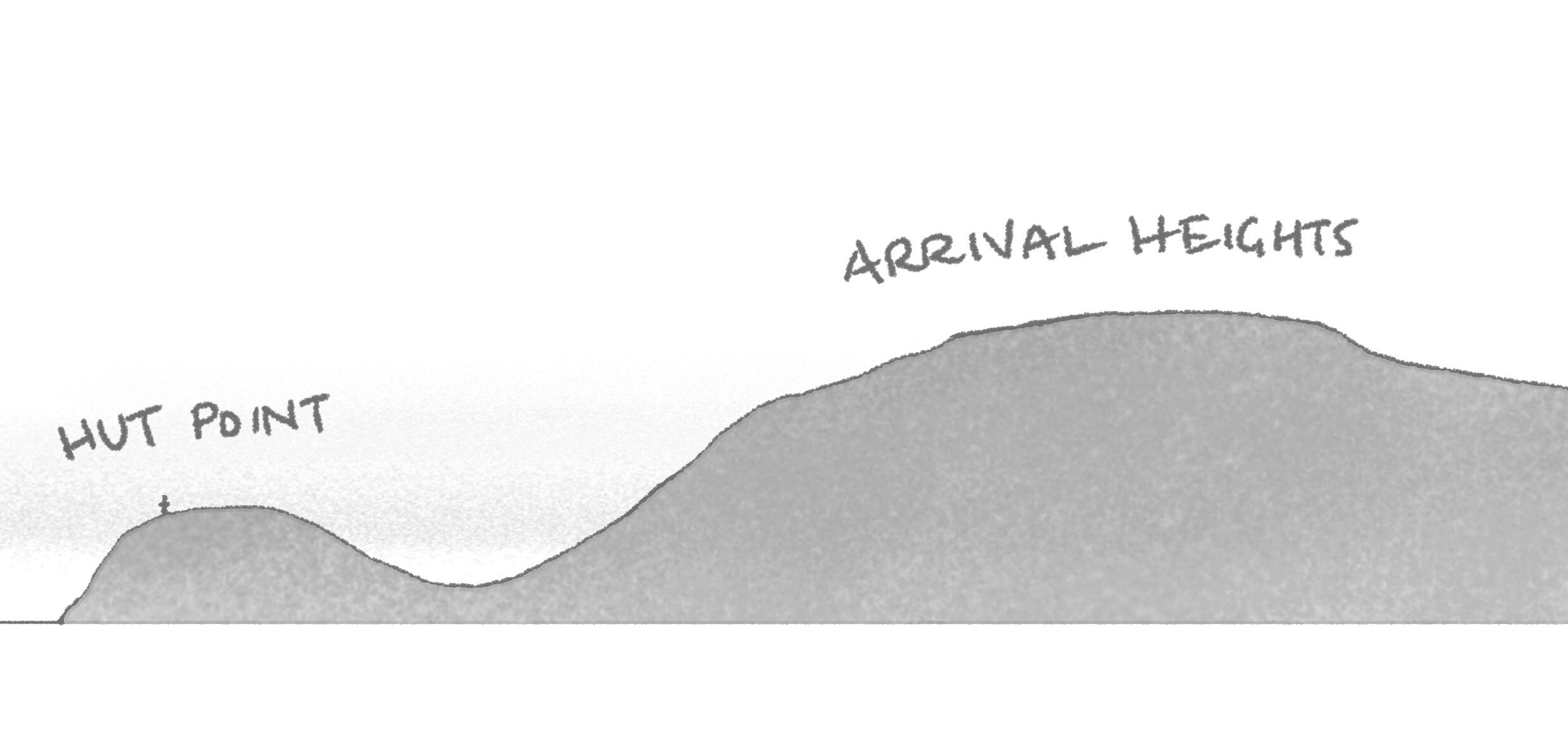
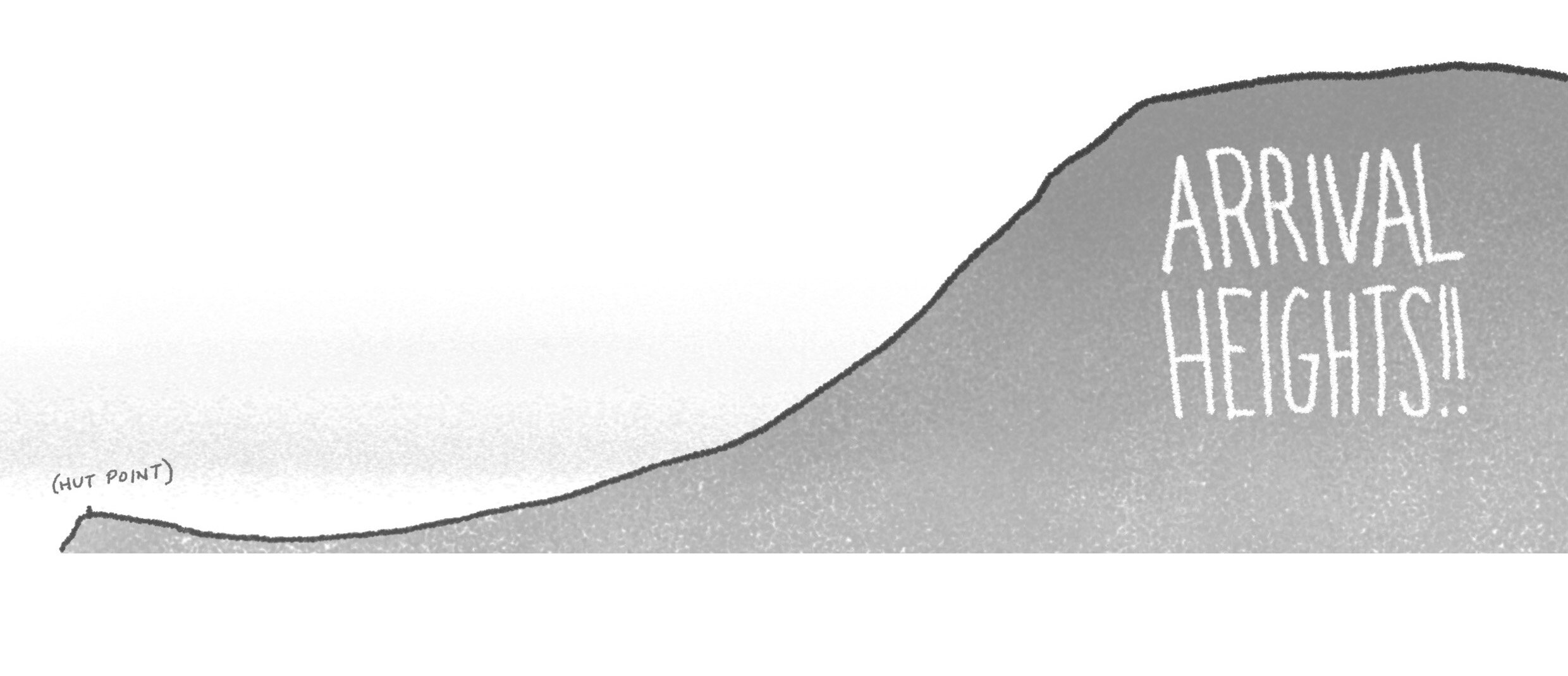
In reality – and I frequently found myself staring at this view, trying to comprehend my shattered expectations – it is more like this:
The trailhead is just behind the Discovery Hut. I was a little apprehensive about how my poor legs, atrophied by life on the Fens, were going to handle the great incline, but I would just have to find out. My more immediate concern was the skuas.

What an innocuous little bird, there, the sun glinting on ‘the symphony of brown and gold’ as Wilson described it. Now, it was very exciting to see skuas, especially the first few times, as it meant I was IN ANTARCTICA, but they are scary birds! I had read all about their piratical ways, of course, but my coordinator also told me of the time she was divebombed by one which was after her breakfast – ‘like being hit on the back of the head with a roast chicken.’ I had not been hit yet, but had been buzzed by a few low reconnaissance flights, close enough to see the malice in their eyes. They were, apparently, nesting, and though I hadn’t seen any evidence of chicks or even eggs yet, they were clearly feeling In A Family Way and defending their sites accordingly. A pair of them had set up house on the ridge near the Hut, and the trail looked like it was going to pass dangerously close. I escaped with my scalp this time, perhaps because I was quiet and alone and gave them due obeisance as I passed.
The next point of interest was a memorial to Richard Williams, a US Navy man who was hauling some of the supplies for the building of McMurdo across the sea ice when his tractor broke through and he drowned. The Chaplain at the time was Catholic (I don’t know about Mr. Williams) and happened to have a statue of Mary on hand (as you do), so erected a shrine which became known as Our Lady of the Snows.

Because of the improvised grotto, she has been nicknamed ‘Rollcage Mary.’ Some find this offensive, but I suspect the teenage mother and refugee whose firstborn son was lynched by occupying forces can probably take it in stride.
Onwards and upwards!

It’s not long before you start to get a high vantage on Hut Point. That’s Mt Discovery across the Sound, and Black Island poking its head above the thin strip of cloud. Out Lady of the Snows is at lower left. If you really look, you can see the low pyramid roof of the Discovery Hut halfway between the Hut Point promontory and the next bump of land.
Facing the other direction gives you a good demonstration of how, when they say Arrival Heights, they mean HEIGHTS. It’s one long, steep slope of igneous scree all the way to the tide crack at the bottom. The word ‘precipitous’ was at the front of my mind.

That night, there was a north wind – not very strong, but enough to make a big difference in one’s perception of temperature, depending on the degree to which one was sheltered. As expected, if I stood right on the ridgeline, I got the wind full in my face, but if I stepped back even a couple of feet, it was calm. This ended up being a very important discovery later, so I illustrate the principle for you here.
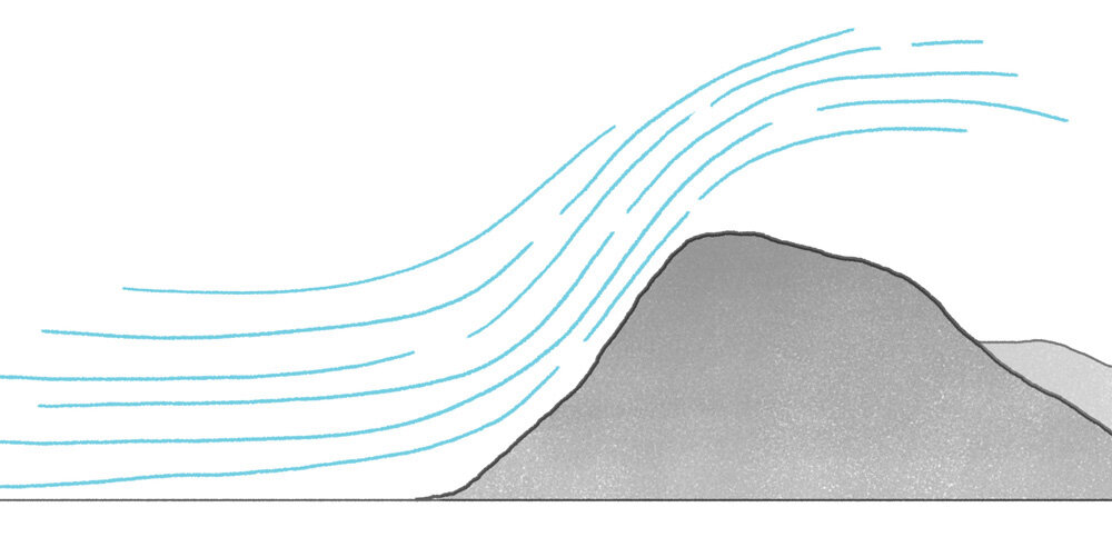
![[L] Standing on the ridgeline, in the wind. [R] Standing back from the ridgeline, out of the wind.](https://images.squarespace-cdn.com/content/v1/5205b8f0e4b04f935ee86748/1578925998755-18A5ENAIV9BN8U4FJCK6/wind-figures.jpg)
[L] Standing on the ridgeline, in the wind. [R] Standing back from the ridgeline, out of the wind.
If you’ve ever driven in a convertible with the top down, it’s the same phenomenon by which the windscreen keeps air in the interior space of the car relatively still.

One sometimes gets the impression, around McMurdo, of being on Mars, but up here, away from the town, the impression gets much stronger. This radome can be seen all around the station, but without the context of town, it takes on a more extraterrestrial flavour.
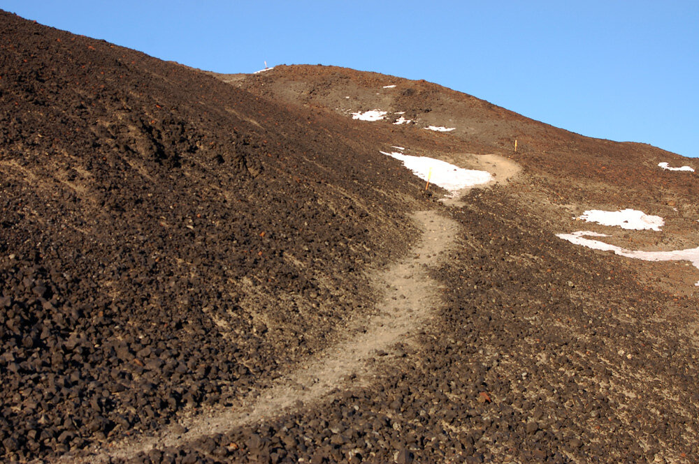
Partly, the Martian impression is made by the exposed earth of the Hut Point Peninsula. Scientists are keen to remind us that there are all sorts of exciting microbes living in Antarctic soil, but it looks completely dead to the naked eye. What you can’t tell in the photo is that it’s also very loose: the trail here is packed, but if you were to come up here without it, you’d find it hard to get a foothold. Instead of the bedrock with a thin layer of loose pebbles and dust, as I’m used to from hiking in mountains, it feels like the whole hill is a dirt pile. The porous lava rock is light for its volume, and the continuous cycles of extreme cold and sun-warmed thaw keeps breaking it into smaller and smaller pieces, so it feels almost like walking on breakfast cereal.
Here is a closer look at some rock in the process of breaking into smaller rocks. I could have pulled it apart with my hands if I’d tried.

From up here, the view down to Hut Point not only reinforces how high Arrival Heights is, but how incredibly tiny and isolated the Discovery Hut would have been in a vast, incredibly vast, magnificently vast polar wilderness.

Officially, the trail loops up to the radome and then down the access road and through town, but this would have added a good deal of time without adding much interest. The scramble down was pretty quick, and I hardly had to do any of it on my bum. I got back down to the starting point just after midnight, so to prove a point about the 24-hour sunshine:

To be fully transparent, here, astronomical midnight was fifty minutes away – McMurdo functions on New Zealand time, which, being summer, was on Daylight Savings, so real midnight is at 01.00. But that was late enough for me, and I went to bed worthily exhausted and satisfied with a job well done.